
سمامة topographic map
Interactive map
Click on the map to display elevation.
About this map
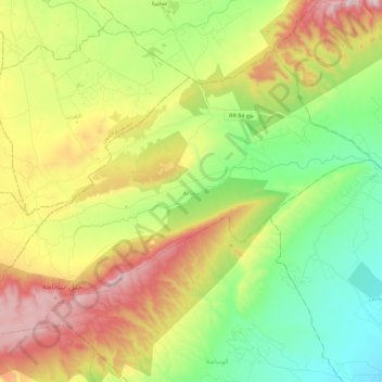
Name: سمامة topographic map, elevation, terrain.
Location: سمامة, سبيطلة, Kasserine, Tunisia (35.30547 8.79915 35.44277 9.02198)
Average elevation: 3,005 ft
Minimum elevation: 2,077 ft
Maximum elevation: 4,426 ft
Other topographic maps
Click on a map to view its topography, its elevation and its terrain.