
La Panouse topographic map
Interactive map
Click on the map to display elevation.
About this map
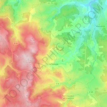
Name: La Panouse topographic map, elevation, terrain.
Location: La Panouse, Mende, Lozère, Occitanie, France, 48600, France (44.69870 3.53126 44.77633 3.64582)
Average elevation: 4,314 ft
Minimum elevation: 3,747 ft
Maximum elevation: 4,925 ft