
Mercus-Garrabet topographic map
Interactive map
Click on the map to display elevation.
About this map
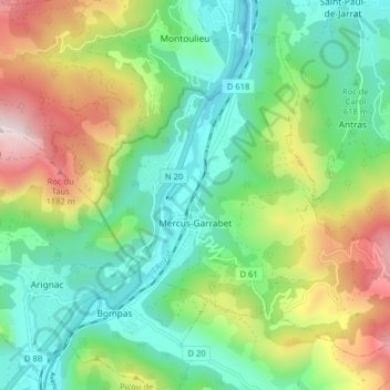
Name: Mercus-Garrabet topographic map, elevation, terrain.
Location: Mercus-Garrabet, Foix, Ariège, Occitanie, France, 09400, France (42.85931 1.61021 42.90854 1.69023)
Average elevation: 2,382 ft
Minimum elevation: 1,375 ft
Maximum elevation: 4,390 ft