
citarum topographic map
Interactive map
Click on the map to display elevation.
About this map
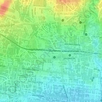
Name: citarum topographic map, elevation, terrain.
Location: citarum, Bandung, West Java, 40172, Indonesia (-6.91489 107.59537 -6.91369 107.59550)
Average elevation: 2,359 ft
Minimum elevation: 2,297 ft
Maximum elevation: 2,464 ft
Other topographic maps
Click on a map to view its topography, its elevation and its terrain.
Antapani Kidul
Indonesia > West Java > Bandung
Antapani Kidul, Antapani, Bandung, West Java, Java, 40291, Indonesia
Average elevation: 2,231 ft
serang
Indonesia > West Java > Bandung > Kebon Pisang
serang, Jalan Saad, Kebon Pisang, Sumur Bandung, Bandung, West Java, 40261, Indonesia
Average elevation: 2,313 ft