
Cranleigh topographic map
Interactive map
Click on the map to display elevation.
About this map
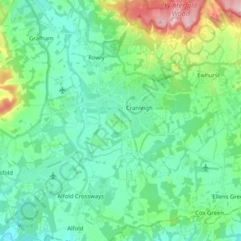
Name: Cranleigh topographic map, elevation, terrain.
Average elevation: 256 ft
Minimum elevation: 79 ft
Maximum elevation: 843 ft
Elevations range from a maximum of 240 m AOD (mean high water level) at the car park on Reynolds Hill in Winterfold Heath (a woodland in the north) to 41 m on the watercourse and the disused Wey and Arun Canal as they leave both the parish in the northwest extreme at the end of East Whipley Lane. The village centre lies at generally 50–70 m above AOD.