
Altaş topographic map
Interactive map
Click on the map to display elevation.
About this map
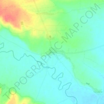
Name: Altaş topographic map, elevation, terrain.
Location: Altaş, Afşin, Kahramanmaraş, Mediterranean Region, Turkey (38.15009 36.95892 38.19009 36.99892)
Average elevation: 3,701 ft
Minimum elevation: 3,642 ft
Maximum elevation: 3,845 ft