
Luozi topographic map
Interactive map
Click on the map to display elevation.
About this map
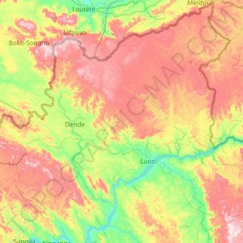
Name: Luozi topographic map, elevation, terrain.
Location: Luozi, Kongo-Central, DR Congo (-5.27544 13.44227 -4.27824 14.48067)
Average elevation: 1,391 ft
Minimum elevation: 522 ft
Maximum elevation: 2,772 ft