Jesus de Machaca topographic map
Interactive map
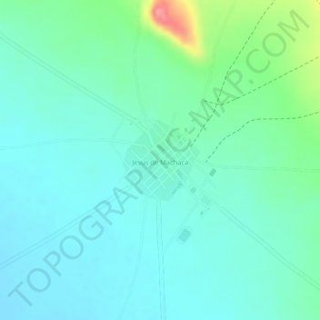
Click on the map to display elevation.
About this map
Name: Jesus de Machaca topographic map, elevation, terrain.
Average elevation: 12,674 ft
Minimum elevation: 12,598 ft
Maximum elevation: 12,904 ft

Click on the map to display elevation.
Name: Jesus de Machaca topographic map, elevation, terrain.
Average elevation: 12,674 ft
Minimum elevation: 12,598 ft
Maximum elevation: 12,904 ft