
Mayotte topographic map
Interactive map
Click on the map to display elevation.
About this map
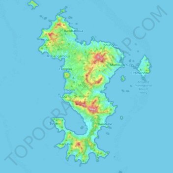
Name: Mayotte topographic map, elevation, terrain.
Location: Mayotte, France (-13.02101 45.01833 -12.63659 45.29999)
Average elevation: 89 ft
Minimum elevation: 0 ft
Maximum elevation: 1,998 ft
Other topographic maps
Click on a map to view its topography, its elevation and its terrain.