
Abegondo topographic map
Interactive map
Click on the map to display elevation.
About this map
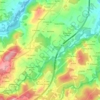
Name: Abegondo topographic map, elevation, terrain.
Location: Abegondo, Cancelada, A Coruña, Galicia, 15318, Spain (43.20613 -8.29778 43.24613 -8.25778)
Average elevation: 394 ft
Minimum elevation: 128 ft
Maximum elevation: 728 ft