
Mooloolah Valley topographic map
Interactive map
Click on the map to display elevation.
About this map
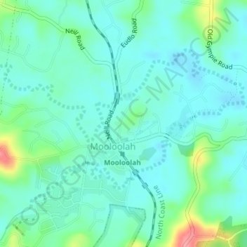
Name: Mooloolah Valley topographic map, elevation, terrain.
Location: Mooloolah Valley, Mooloolah, Queensland, 4554, Australia (-26.77250 152.95333 -26.75250 152.97333)
Average elevation: 138 ft
Minimum elevation: 69 ft
Maximum elevation: 384 ft
Other topographic maps
Click on a map to view its topography, its elevation and its terrain.
Mooloolah
Australia > Queensland > Mooloolah
Mooloolah, Sunshine Coast, Queensland, 4553, Australia
Average elevation: 174 ft
Dularcha National Park
Australia > Queensland > Landsborough > Mooloolah
Dularcha National Park, Dlurcha Drive, Landsborough, Queensland, 4553, Australia
Average elevation: 246 ft