
Bokhorst topographic map
Interactive map
Click on the map to display elevation.
About this map
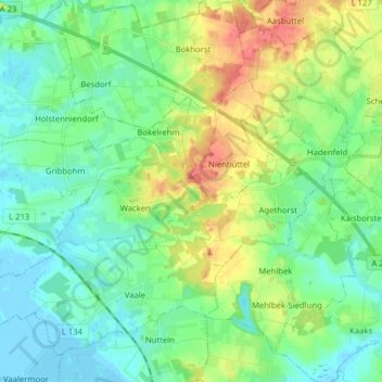
Name: Bokhorst topographic map, elevation, terrain.
Location: Bokhorst, Schenefeld, Steinburg, Schleswig-Holstein, Deutschland (53.97741 9.28756 54.07030 9.42809)
Average elevation: 62 ft
Minimum elevation: -13 ft
Maximum elevation: 203 ft