
Ouargla topographic map
Interactive map
Click on the map to display elevation.
About this map
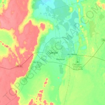
Name: Ouargla topographic map, elevation, terrain.
Location: Ouargla, Ouargla District, Ouargla, 30009, Algeria (31.78467 5.16096 32.10467 5.48096)
Average elevation: 541 ft
Minimum elevation: 384 ft
Maximum elevation: 820 ft