
Kalgoorlie topographic map
Interactive map
Click on the map to display elevation.
About this map
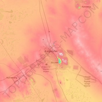
Name: Kalgoorlie topographic map, elevation, terrain.
Location: Kalgoorlie, Western Australia, 6432, Australia (-30.90641 121.31322 -30.58641 121.63322)
Average elevation: 1,181 ft
Minimum elevation: 604 ft
Maximum elevation: 1,476 ft
Other topographic maps
Click on a map to view its topography, its elevation and its terrain.
Kalgoorlie
Australia > Western Australia > Kalgoorlie
Kalgoorlie, City Of Kalgoorlie-Boulder, Western Australia, Australia
Average elevation: 1,234 ft