
Böhne topographic map
Interactive map
Click on the map to display elevation.
About this map
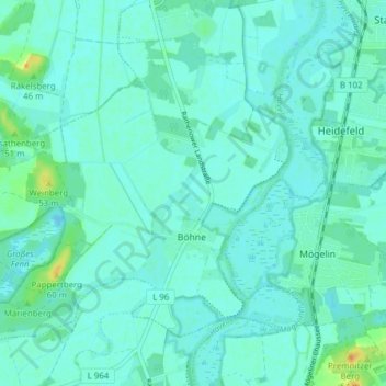
Name: Böhne topographic map, elevation, terrain.
Location: Böhne, Rathenow, Havelland, Brandenburg, Germany (52.54663 12.25333 52.58451 12.33044)
Average elevation: 98 ft
Minimum elevation: 82 ft
Maximum elevation: 171 ft
Other topographic maps
Click on a map to view its topography, its elevation and its terrain.
Rathenow
Germany > Brandenburg > Rathenow
Rathenow, Havelland, Brandenburg, Germany
Average elevation: 102 ft