
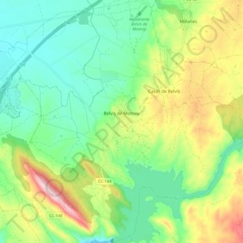
Belvís de Monroy topographic map
Interactive map
Click on the map to display elevation.
About this map
Name: Belvís de Monroy topographic map, elevation, terrain.
Location: Belvís de Monroy, Campo Arañuelo, Cáceres, Extremadura, España (39.77702 -5.65702 39.85575 -5.56106)
Average elevation: 1,155 ft
Minimum elevation: 801 ft
Maximum elevation: 1,834 ft