
Moheli topographic map
Interactive map
Click on the map to display elevation.
About this map
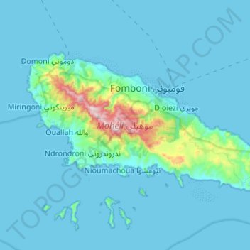
Name: Moheli topographic map, elevation, terrain.
Location: Moheli, Comoros (-12.39201 43.62239 -12.24892 43.87127)
Average elevation: 194 ft
Minimum elevation: 0 ft
Maximum elevation: 2,500 ft