
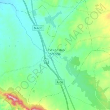
Casas de Don Antonio topographic map
Interactive map
Click on the map to display elevation.
About this map
Name: Casas de Don Antonio topographic map, elevation, terrain.
Location: Casas de Don Antonio, Cáceres, Extremadura, España (39.18445 -6.32155 39.28225 -6.24828)
Average elevation: 1,388 ft
Minimum elevation: 1,191 ft
Maximum elevation: 2,057 ft