
O Esto topographic map
Interactive map
Click on the map to display elevation.
About this map
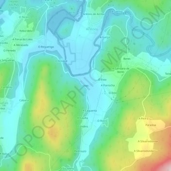
Name: O Esto topographic map, elevation, terrain.
Location: O Esto, Leas, Bergantiños, A Coruña, Galicia, 15149, España (43.19517 -8.91162 43.23517 -8.87162)
Average elevation: 272 ft
Minimum elevation: 0 ft
Maximum elevation: 1,079 ft