
Folldal topographic map
Interactive map
Click on the map to display elevation.
About this map
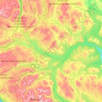
Name: Folldal topographic map, elevation, terrain.
Location: Folldal, Innlandet, Norway (61.88445 9.58383 62.42781 10.39159)
Average elevation: 3,638 ft
Minimum elevation: 1,594 ft
Maximum elevation: 7,064 ft
Other topographic maps
Click on a map to view its topography, its elevation and its terrain.