
Bruce Township topographic map
Interactive map
Click on the map to display elevation.
About this map
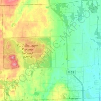
Name: Bruce Township topographic map, elevation, terrain.
Location: Bruce Township, Macomb County, Michigan, 48065, USA (42.80055 -83.10289 42.89374 -82.97983)
Average elevation: 869 ft
Minimum elevation: 735 ft
Maximum elevation: 1,129 ft