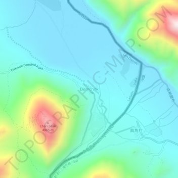
Demchok topographic map
Interactive map
Click on the map to display elevation.
About this map
Name: Demchok topographic map, elevation, terrain.
Average elevation: 14,278 ft
Minimum elevation: 13,753 ft
Maximum elevation: 16,243 ft

Click on the map to display elevation.
Name: Demchok topographic map, elevation, terrain.
Average elevation: 14,278 ft
Minimum elevation: 13,753 ft
Maximum elevation: 16,243 ft