
Hendrieken topographic map
Interactive map
Click on the map to display elevation.
About this map
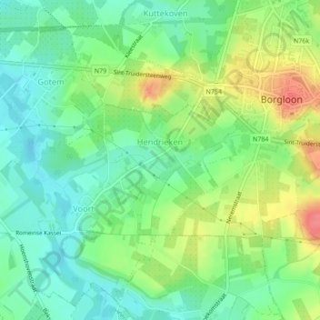
Name: Hendrieken topographic map, elevation, terrain.
Location: Hendrieken, Borgloon, Tongeren, Limburg, Flanders, Belgium (50.79094 5.31986 50.80363 5.33806)
Average elevation: 256 ft
Minimum elevation: 167 ft
Maximum elevation: 397 ft
Other topographic maps
Click on a map to view its topography, its elevation and its terrain.