
Gadhinglaj topographic map
Interactive map
Click on the map to display elevation.
About this map
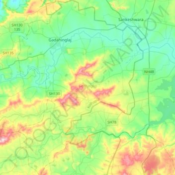
Name: Gadhinglaj topographic map, elevation, terrain.
Location: Gadhinglaj, Kolhapur district, Maharashtra, India (15.98014 74.27213 16.29442 74.50702)
Average elevation: 2,326 ft
Minimum elevation: 1,969 ft
Maximum elevation: 3,202 ft