
Gonbad topographic map
Interactive map
Click on the map to display elevation.
About this map
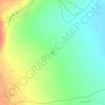
Name: Gonbad topographic map, elevation, terrain.
Location: Gonbad, بخش مرکزی, Khoy County, West Azerbaijan Province, Iran (38.47553 44.87537 38.51553 44.91537)
Average elevation: 3,927 ft
Minimum elevation: 3,848 ft
Maximum elevation: 4,052 ft