
Bourdeaux topographic map
Interactive map
Click on the map to display elevation.
About this map
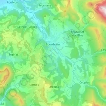
Name: Bourdeaux topographic map, elevation, terrain.
Average elevation: 1,972 ft
Minimum elevation: 1,079 ft
Maximum elevation: 4,629 ft
Dictionnaire topographique du département de la Drôme.