
Nanga-nangaon topographic map
Interactive map
Click on the map to display elevation.
About this map
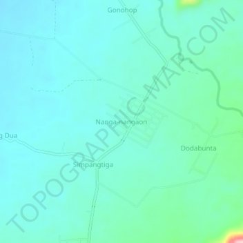
Name: Nanga-nangaon topographic map, elevation, terrain.
Location: Nanga-nangaon, Banggai Regency, Central Sulawesi, Indonesia (-0.93445 122.23957 -0.89445 122.27957)
Average elevation: 272 ft
Minimum elevation: 164 ft
Maximum elevation: 856 ft