
Le Morvan topographic map
Interactive map
Click on the map to display elevation.
About this map
Name: Le Morvan topographic map, elevation, terrain.
Average elevation: 341 ft
Minimum elevation: 308 ft
Maximum elevation: 387 ft
Other topographic maps
Click on a map to view its topography, its elevation and its terrain.
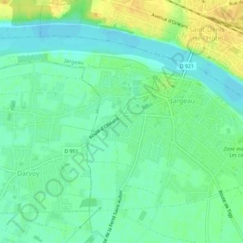
Jargeau
France > Centre-Val de Loire > Jargeau
Jargeau, Orléans, Loiret, Centre-Val de Loire, France métropolitaine, 45150, France
Average elevation: 344 ft