
Staniel Cay topographic map
Interactive map
Click on the map to display elevation.
About this map
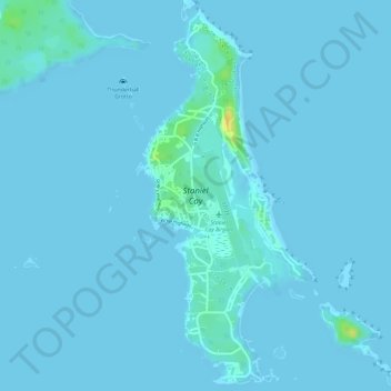
Name: Staniel Cay topographic map, elevation, terrain.
Location: Staniel Cay, Exuma, The Bahamas (24.15759 -76.44550 24.18371 -76.43239)
Average elevation: 7 ft
Minimum elevation: 0 ft
Maximum elevation: 92 ft
Other topographic maps
Click on a map to view its topography, its elevation and its terrain.
Little Darby Island
Little Darby Island, Exuma, The Bahamas
Average elevation: 0 ft
Little Halls Pond Cay
Little Halls Pond Cay, Exuma, The Bahamas
Average elevation: 0 ft
Lee Stocking Island
Lee Stocking Island, Exuma, The Bahamas
Average elevation: 3 ft