Taklamakan Desert topographic map
Interactive map
Click on the map to display elevation.
About this map
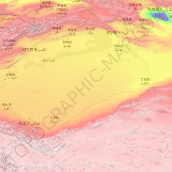
Name: Taklamakan Desert topographic map, elevation, terrain.
Average elevation: 8,658 ft
Minimum elevation: -505 ft
Maximum elevation: 22,395 ft

Click on the map to display elevation.
Name: Taklamakan Desert topographic map, elevation, terrain.
Average elevation: 8,658 ft
Minimum elevation: -505 ft
Maximum elevation: 22,395 ft