
Sewanee topographic map
Interactive map
Click on the map to display elevation.
About this map
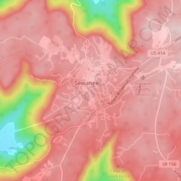
Name: Sewanee topographic map, elevation, terrain.
Location: Sewanee, Franklin County, Tennessee, 37383, United States (35.17245 -85.94703 35.22883 -85.89970)
Average elevation: 1,768 ft
Minimum elevation: 988 ft
Maximum elevation: 2,034 ft
Sewanee lies on the western edge of the Cumberland Plateau in the southeastern part of Middle Tennessee. It is located at 35°12′4″N 85°55′17″W / 35.20111°N 85.92139°W / 35.20111; -85.92139 (35.201232, -85.921524). It is at elevation 1,929 feet (588 m).