
Pisa topographic map
Interactive map
Click on the map to display elevation.
About this map
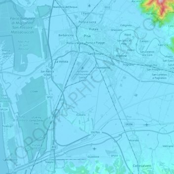
Name: Pisa topographic map, elevation, terrain.
Location: Pisa, Tuscany, Italy (43.58072 10.26846 43.75093 10.45628)
Average elevation: 36 ft
Minimum elevation: -16 ft
Maximum elevation: 2,359 ft
Other topographic maps
Click on a map to view its topography, its elevation and its terrain.
San Casciano
Italy > Tuscany > Pisa > Cascina
San Casciano, Cascina, Pisa, Tuscany, 56021, Italy
Average elevation: 187 ft