
Kothamangalam topographic map
Interactive map
Click on the map to display elevation.
About this map
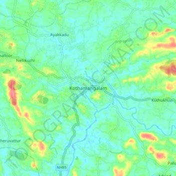
Name: Kothamangalam topographic map, elevation, terrain.
Location: Kothamangalam, Ernakulam, Kerala, India (10.02403 76.58182 10.10403 76.66182)
Average elevation: 112 ft
Minimum elevation: 49 ft
Maximum elevation: 295 ft