
真庭郡 topographic map
Interactive map
Click on the map to display elevation.
About this map
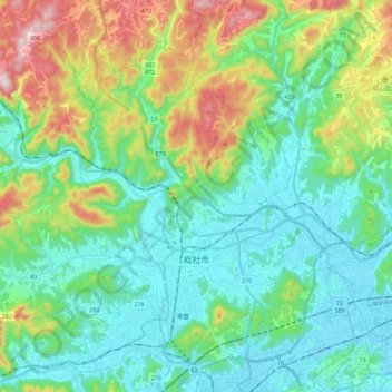
Name: 真庭郡 topographic map, elevation, terrain.
Location: Sōja, 真庭郡, Préfecture d'Okayama, Chūgoku, Japon (34.62230 133.58182 34.78160 133.80429)
Average elevation: 456 ft
Minimum elevation: 0 ft
Maximum elevation: 1,762 ft
Other topographic maps
Click on a map to view its topography, its elevation and its terrain.