
Millstreet topographic map
Interactive map
Click on the map to display elevation.
About this map
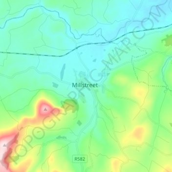
Name: Millstreet topographic map, elevation, terrain.
Location: Millstreet, County Cork, Munster, Ireland (52.01960 -9.10291 52.09960 -9.02291)
Average elevation: 561 ft
Minimum elevation: 276 ft
Maximum elevation: 1,565 ft