
Ger topographic map
Interactive map
Click on the map to display elevation.
About this map
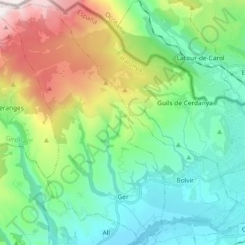
Name: Ger topographic map, elevation, terrain.
Location: Ger, Cerdanya, Girona, Catalonia, Spain (42.39260 1.76191 42.48758 1.86922)
Average elevation: 4,974 ft
Minimum elevation: 3,451 ft
Maximum elevation: 8,825 ft