
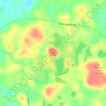
Timms Hill topographic map
Interactive map
Click on the map to display elevation.
About this map
Name: Timms Hill topographic map, elevation, terrain.
Average elevation: 1,814 ft
Minimum elevation: 1,699 ft
Maximum elevation: 1,936 ft
Timms Hill or Timm's Hill is the highest natural point in the U.S. state of Wisconsin and is located in north-central Wisconsin in Timms Hill County Park in the Town of Hill in Price County. After being surveyed by Quentin Stevens of Ogema Telephone Co in 1962, Timms Hill was discovered to have an elevation of 1,951.5 ft (595 m). It is less than 1 mile (1.6 km) south of Highway 86, about midway between Ogema and Spirit and about 23 miles (37 km) west of Tomahawk.
Other topographic maps
Click on a map to view its topography, its elevation and its terrain.
Kennan
United States > Wisconsin > Price County
Kennan, Price County, Wisconsin, United States
Average elevation: 1,499 ft
Dover
United States > Wisconsin > Price County
Dover, Town of Emery, Price County, Wisconsin, United States
Average elevation: 1,654 ft
Worcester
United States > Wisconsin > Price County
Worcester, Town of Hackett, Price County, Wisconsin, United States
Average elevation: 1,594 ft
Ogema
United States > Wisconsin > Price County
Ogema, Town of Ogema, Price County, Wisconsin, United States
Average elevation: 1,565 ft
Smith Lake County Park
United States > Wisconsin > Price County > Park Falls
Smith Lake County Park, Park Falls, Town of Eisenstein, Price County, Wisconsin, 54896, United States
Average elevation: 1,480 ft
Phillips
United States > Wisconsin > Price County
Phillips, Price County, Wisconsin, 54555, United States
Average elevation: 1,463 ft
Catawba
United States > Wisconsin > Price County
Catawba, Price County, Wisconsin, United States
Average elevation: 1,493 ft
Kennedy
United States > Wisconsin > Price County > Kennedy
Kennedy, Town of Lake, Price County, Wisconsin, United States
Average elevation: 1,470 ft
Prentice
United States > Wisconsin > Price County
Prentice, Price County, Wisconsin, 54556, United States
Average elevation: 1,552 ft