
Bushnell topographic map
Interactive map
Click on the map to display elevation.
About this map
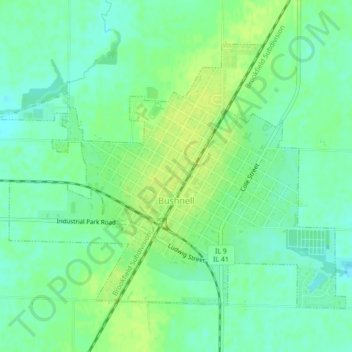
Name: Bushnell topographic map, elevation, terrain.
Location: Bushnell, McDonough County, Illinois, United States (40.54097 -90.53257 40.56599 -90.48873)
Average elevation: 643 ft
Minimum elevation: 617 ft
Maximum elevation: 669 ft
Other topographic maps
Click on a map to view its topography, its elevation and its terrain.
Lamone Village
United States > Illinois > McDonough County > Macomb > Lamone Village
Lamone Village, Macomb, McDonough County, Illinois, 61455, United States
Average elevation: 673 ft
Sciota
United States > Illinois > McDonough County
Sciota, McDonough County, Illinois, United States
Average elevation: 758 ft