
Salto Grande topographic map
Interactive map
Click on the map to display elevation.
About this map
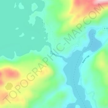
Name: Salto Grande topographic map, elevation, terrain.
Average elevation: 341 ft
Minimum elevation: 82 ft
Maximum elevation: 1,020 ft
Other topographic maps
Click on a map to view its topography, its elevation and its terrain.
Grey Glacier
Chile > XII Region of Magallanes and Chilean Antarctica > Torres del Paine
Grey Glacier, Torres del Paine, Provincia de Última Esperanza, XII Region of Magallanes and Chilean Antarctica, Chile
Average elevation: 3,041 ft