
Frosta topographic map
Interactive map
Click on the map to display elevation.
About this map
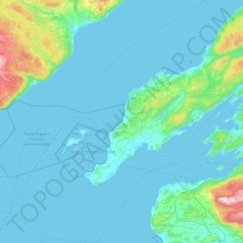
Name: Frosta topographic map, elevation, terrain.
Location: Frosta, Trøndelag, 7633, Norway (63.49054 10.48858 63.69328 10.94682)
Average elevation: 207 ft
Minimum elevation: -10 ft
Maximum elevation: 1,926 ft
Other topographic maps
Click on a map to view its topography, its elevation and its terrain.