
Fissure Glacier topographic map
Interactive map
Click on the map to display elevation.
About this map
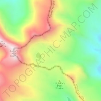
Name: Fissure Glacier topographic map, elevation, terrain.
Location: Fissure Glacier, Missoula, United States of America (47.31238 -113.88654 47.31248 -113.88644)
Average elevation: 7,969 ft
Minimum elevation: 6,795 ft
Maximum elevation: 9,298 ft
Other topographic maps
Click on a map to view its topography, its elevation and its terrain.
Mountaineer Glacier
United States of America > Missoula
Mountaineer Glacier, Missoula, United States of America
Average elevation: 7,756 ft
Gray Wolf Glacier
United States of America > Missoula
Gray Wolf Glacier, Missoula, United States of America
Average elevation: 7,543 ft