
Parshall topographic map
Interactive map
Click on the map to display elevation.
About this map
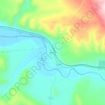
Name: Parshall topographic map, elevation, terrain.
Location: Parshall, Grand County, Colorado, USA (40.03693 -106.19530 40.07693 -106.15530)
Average elevation: 7,831 ft
Minimum elevation: 7,461 ft
Maximum elevation: 8,678 ft