
Petit-Bourg topographic map
Interactive map
Click on the map to display elevation.
About this map
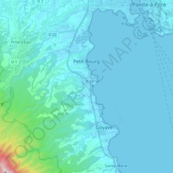
Name: Petit-Bourg topographic map, elevation, terrain.
Location: Petit-Bourg, Basse-Terre, Guadeloupe, 97170, France (16.10264 -61.73606 16.23635 -61.57950)
Average elevation: 302 ft
Minimum elevation: -10 ft
Maximum elevation: 4,154 ft