
Suscévaz topographic map
Interactive map
Click on the map to display elevation.
About this map
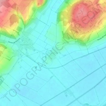
Name: Suscévaz topographic map, elevation, terrain.
Location: Suscévaz, District du Jura-Nord vaudois, Vaud, 1437, Svizzera (46.74745 6.57324 46.78081 6.60253)
Average elevation: 1,512 ft
Minimum elevation: 1,404 ft
Maximum elevation: 1,834 ft