
Tims Ford topographic map
Interactive map
Click on the map to display elevation.
About this map
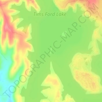
Name: Tims Ford topographic map, elevation, terrain.
Location: Tims Ford, Beech Hill, Franklin County, Tennessee, USA (35.21046 -86.27194 35.21211 -86.27135)
Average elevation: 902 ft
Minimum elevation: 771 ft
Maximum elevation: 1,020 ft
Other topographic maps
Click on a map to view its topography, its elevation and its terrain.
Tims Ford Lake
USA > Tennessee > Beech Hill
Tims Ford Lake, Beech Hill Drive, Beech Hill, Franklin County, Tennessee, 37398, USA
Average elevation: 958 ft