
Hug Point topographic map
Interactive map
Click on the map to display elevation.
About this map
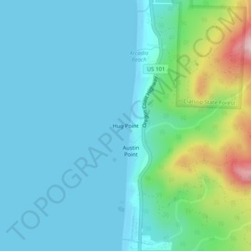
Name: Hug Point topographic map, elevation, terrain.
Location: Hug Point, Arch Cape, Clatsop County, Oregon, 97102, USA (45.82170 -123.97328 45.84170 -123.95328)
Average elevation: 177 ft
Minimum elevation: -7 ft
Maximum elevation: 968 ft