
Тјентиште topographic map
Interactive map
Click on the map to display elevation.
About this map
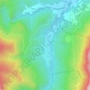
Name: Тјентиште topographic map, elevation, terrain.
Location: Тјентиште, Tjentište, Opština Foča, Republika Srpska, Bosnien (43.33096 18.66766 43.37096 18.70766)
Average elevation: 2,746 ft
Minimum elevation: 1,719 ft
Maximum elevation: 5,157 ft