
Big Island Swamp topographic map
Interactive map
Click on the map to display elevation.
About this map
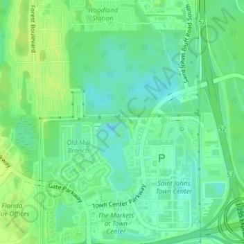
Name: Big Island Swamp topographic map, elevation, terrain.
Average elevation: 36 ft
Minimum elevation: 13 ft
Maximum elevation: 56 ft
Other topographic maps
Click on a map to view its topography, its elevation and its terrain.
Julington Creek
USA > Florida > Jacksonville
Julington Creek, Jacksonville, Duval County, Florida, 32258, USA
Average elevation: 20 ft
Fort George Island
USA > Florida > Jacksonville
Fort George Island, Jacksonville, Duval County, Florida, 32228, USA
Average elevation: 10 ft
Timucuan Ecological & Historic Preserve
USA > Florida > Jacksonville
Timucuan Ecological & Historic Preserve, Big Talbot Island State Park Trail, Jacksonville, Duval County, Florida, USA
Average elevation: 7 ft
Talbot Island
USA > Florida > Jacksonville
Talbot Island, Jacksonville, Duval County, Florida, USA
Average elevation: 10 ft
Burton Island
USA > Florida > Jacksonville
Burton Island, Jacksonville, Duval County, Florida, USA
Average elevation: 20 ft
Big Talbot Island State Park
USA > Florida > Jacksonville
Big Talbot Island State Park, Jacksonville, Duval County, Florida, USA
Average elevation: 7 ft