
Dettifoss topographic map
Interactive map
Click on the map to display elevation.
About this map
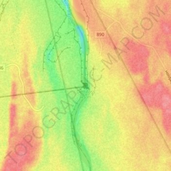
Name: Dettifoss topographic map, elevation, terrain.
Location: Dettifoss, Norðurþing, Northeastern Region, Iceland (65.81429 -16.38448 65.81439 -16.38438)
Average elevation: 1,119 ft
Minimum elevation: 965 ft
Maximum elevation: 1,217 ft
Other topographic maps
Click on a map to view its topography, its elevation and its terrain.
Húsavík
Húsavík, Norðurþing, Northeastern Region, 640, Iceland
Average elevation: 276 ft
Raufarhöfn
Raufarhöfn, Norðurþing, Northeastern Region, 675, Iceland
Average elevation: 43 ft