
Bomoseen topographic map
Interactive map
Click on the map to display elevation.
About this map
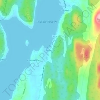
Name: Bomoseen topographic map, elevation, terrain.
Location: Bomoseen, Rutland County, Vermont, 05732, USA (43.62368 -73.21872 43.66368 -73.17872)
Average elevation: 522 ft
Minimum elevation: 407 ft
Maximum elevation: 974 ft